The Gold Road to La Paz Book - The Bradshaw Trail
If you’re fascinated by the history and adventure of the American Southwest, The Gold Road to La Paz: The Bradshaw Trail is a must-have addition to your collection. This book doesn’t just retell the story of the old stage and freight route between San Bernardino and the Colorado River — it transforms it into a modern guide for desert explorers, rockhounds, and history buffs alike.
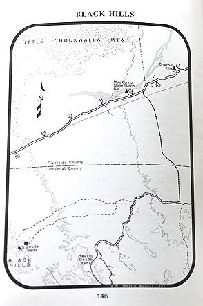
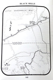
The author takes you down the historic Bradshaw Trail, once a lifeline for miners and traders heading toward La Paz, Arizona. Today, the route is a favorite for 4x4 adventurers and off-road enthusiasts, and this book makes the journey come alive with maps, photos, and fascinating historical context.
What sets this book apart are the side trips and exploration tips sprinkled throughout the pages. Readers will discover:
-
📍 Rockhounding hotspots — areas known for geodes, agates, and other collectible desert stones
-
🏜 Scenic detours to ghost towns, mining camps, and hidden landmarks
-
🚙 Practical guidance for off-road travel and safe desert exploration
-
📖 Rich stories of pioneers, prospectors, and the rugged desert landscape that shaped the trail
Whether you’re planning a day trip, a geology expedition, or simply want to dive into the lore of the Mojave and Colorado Deserts, this book delivers both history and adventure. It’s as much a field guide for desert treasures as it is a window into the past.
In short: The Gold Road to La Paz: The Bradshaw Trail is perfect for anyone who loves desert history, rock collecting, overlanding, or discovering hidden corners of the Southwest.
👉 Add this book to your library and let it guide your next adventure into one of the desert’s most legendary trails.
Hard Cover New over 298 pages with maps and photos.